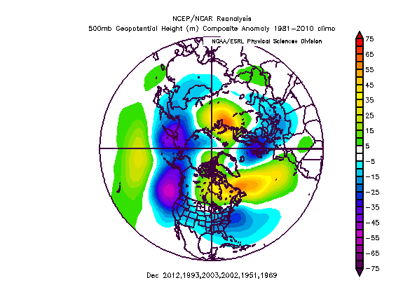
Just went through and revised some of my analog years yesterday, coming up with 51-52,69-70,02-03,03-04,93-94 and 12-13 in the set. Mostly focused on monthly SSN/QBO/MEI numbers with some focus on PDO,AMO,ONI lead up, ENSO configuration, Walker Cell etc. These years appear to hint at a cool and very nino like start to winter with a more nina like finish as the el nino weakens and -EPO forcing takes over. This would more then likely cause the storm track to shift into a more favourable position for our region with the presence of a weak SE ridge. Based on my analogs/research Jan-Mar should be the month's to watch for average to above average snowfall which actually contradicts the modelling(NMME/Euro) which have a wetter/stormier dec and more suppressed storm track from Jan-March.
Dec has that RNA,+WPO,+EPO and neutral NAO/AO look:
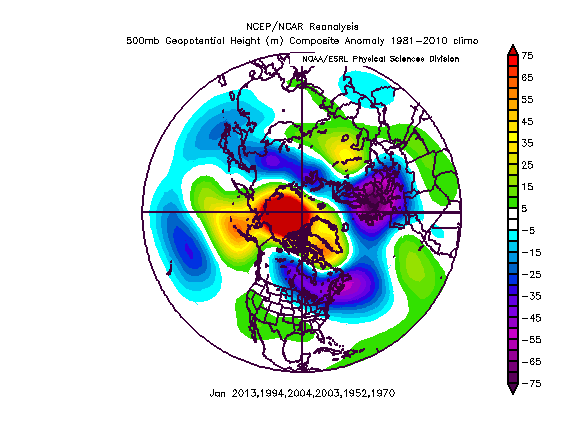
Jan(-EPO,-WPO,-AO/-NAO):
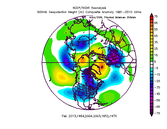
Feb(-NAO/AO,-EPO,+WPO,+PNA)
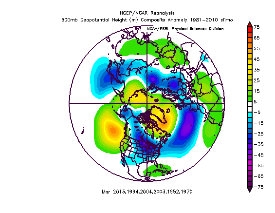
March(+PNA,-WPO,Neutral EPO,-NAO/AO)
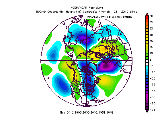
Oh and maybe we can pull off a snowy november finally... very exciting times ahead.
I'd be shocked if that November pattern sets up. Looks like a persistent GOA low will be there for a while. I hope you are correct sir!
ReplyDelete